Spring Source Detection

Published by

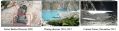
How can I find a spring source diverted by sedimentation in the creation of a huge lake in Attabad Land Slide disaster?  

Which technology could be used to detect the spring but is not too expensive and gives precise results? 


Tags

2 Replies

You may use geophysical ...

You may use geophysical methods coupled with GIS and RS techniwues

Published by

Ali Rehmat  Geographic ...

Ali Rehmat  Geographic Information Systems (GIS) and Remote Sensing are the best method to be used for detecting a spring source.

GIS is used for capturing, storing, managing and analyzing spatial and geographic data.

Satellites or drones can be used to acquire data by remote sensing.

Published by

2 Comments

yah we are facing this situation, we have a hot spring but it located in the bank of river and it need hung amount to lift and other area we don't have such sprigs to findout, this technology is very expensive to acquire data. www.gulbtur.wordpress.com/projects

Published by

Permalink